Pinkuylluna
Mt Pinkuylluna is home to the ruins of the Incan granaries – storehouses where the Incans housed excess crops for storage. Building the storehouses into the side of the mountain kept the crops safe from floods on the valley floor and from any prospective raiders. Winds at the higher altitude probably helped keep the crops dry and prolonged their shelf life. The hike is pretty short – you can reach the main storehouses from old town in about a half hour, but it’s incredibly steep and at some points you can barely discern the path from the surrounding rock. How the Incas carried crops up there I’ll never know.
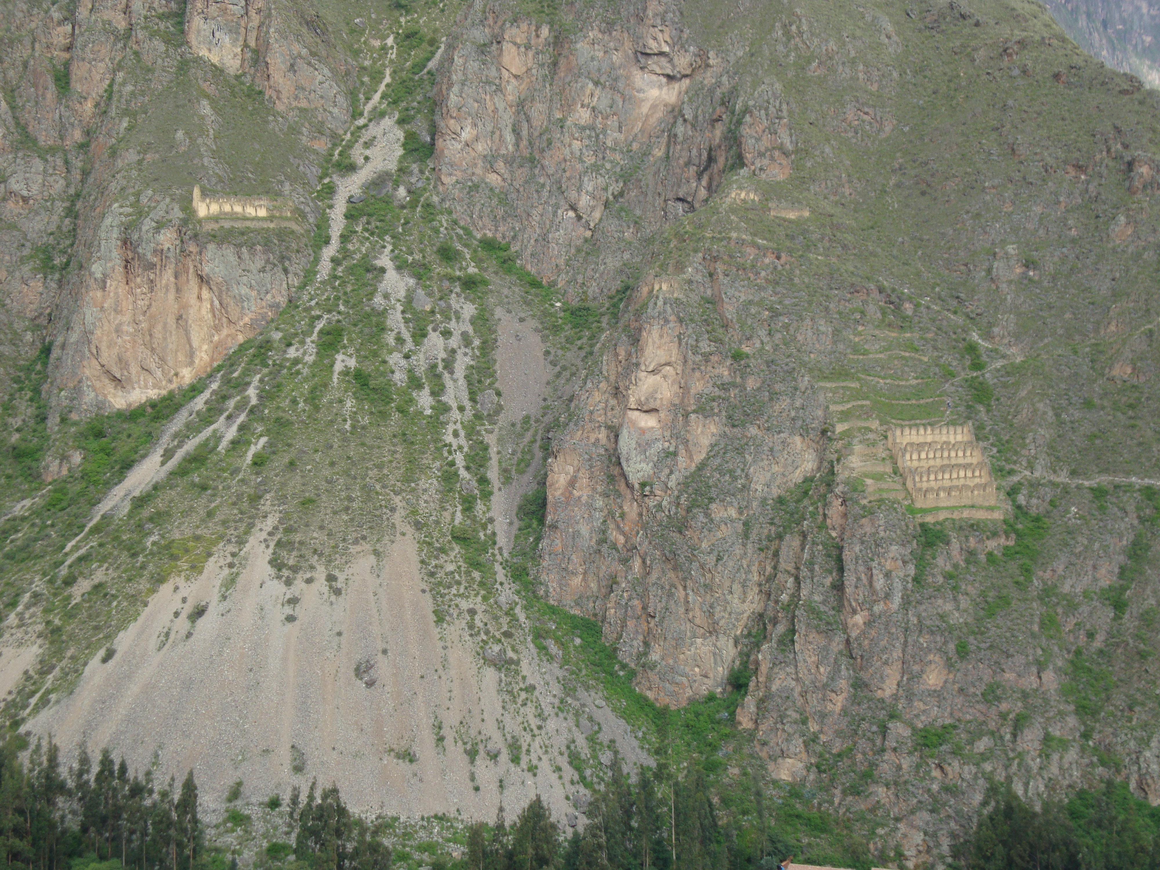
the view of pinkyulluna from intiwatana
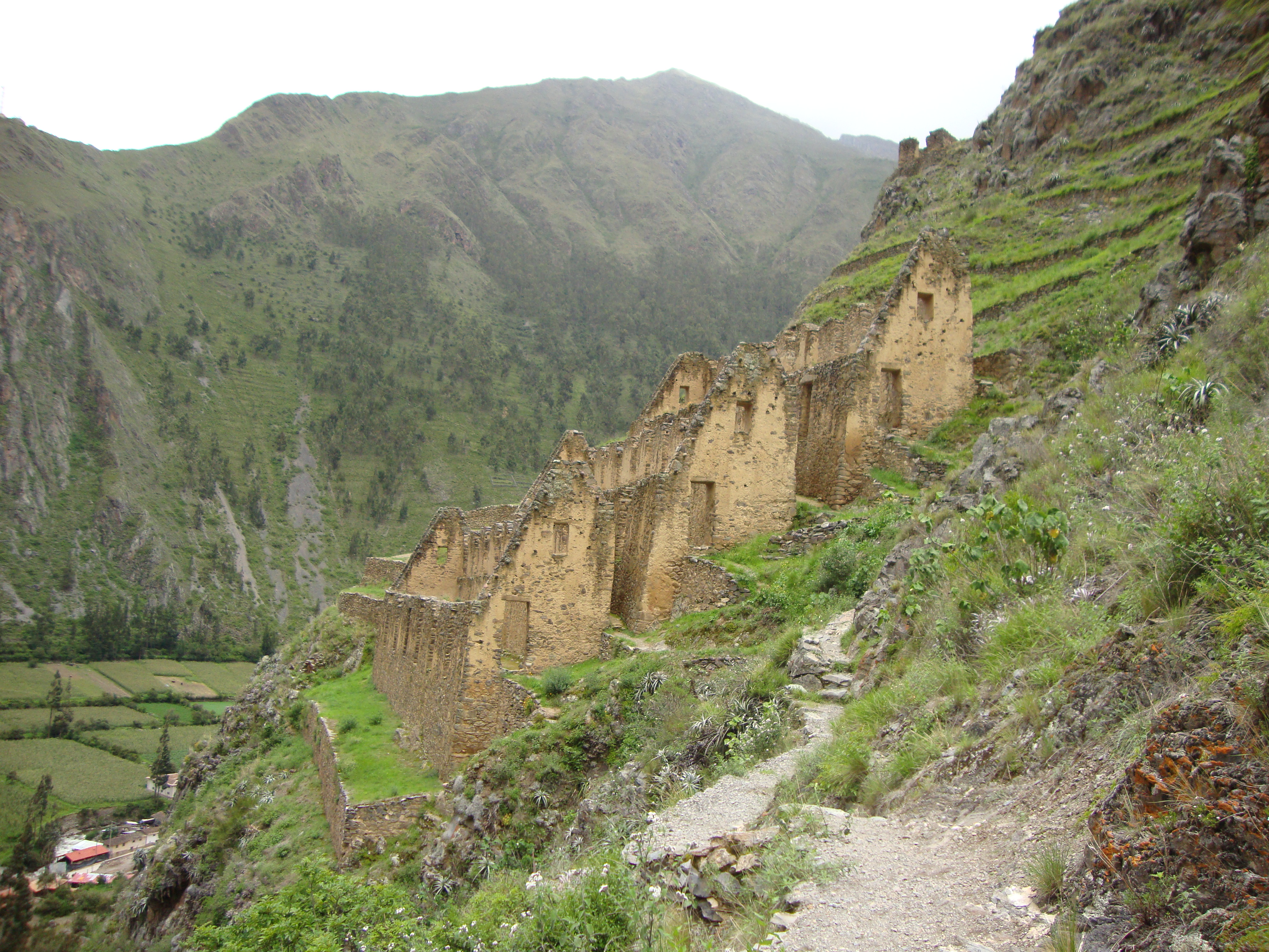
on our way up…
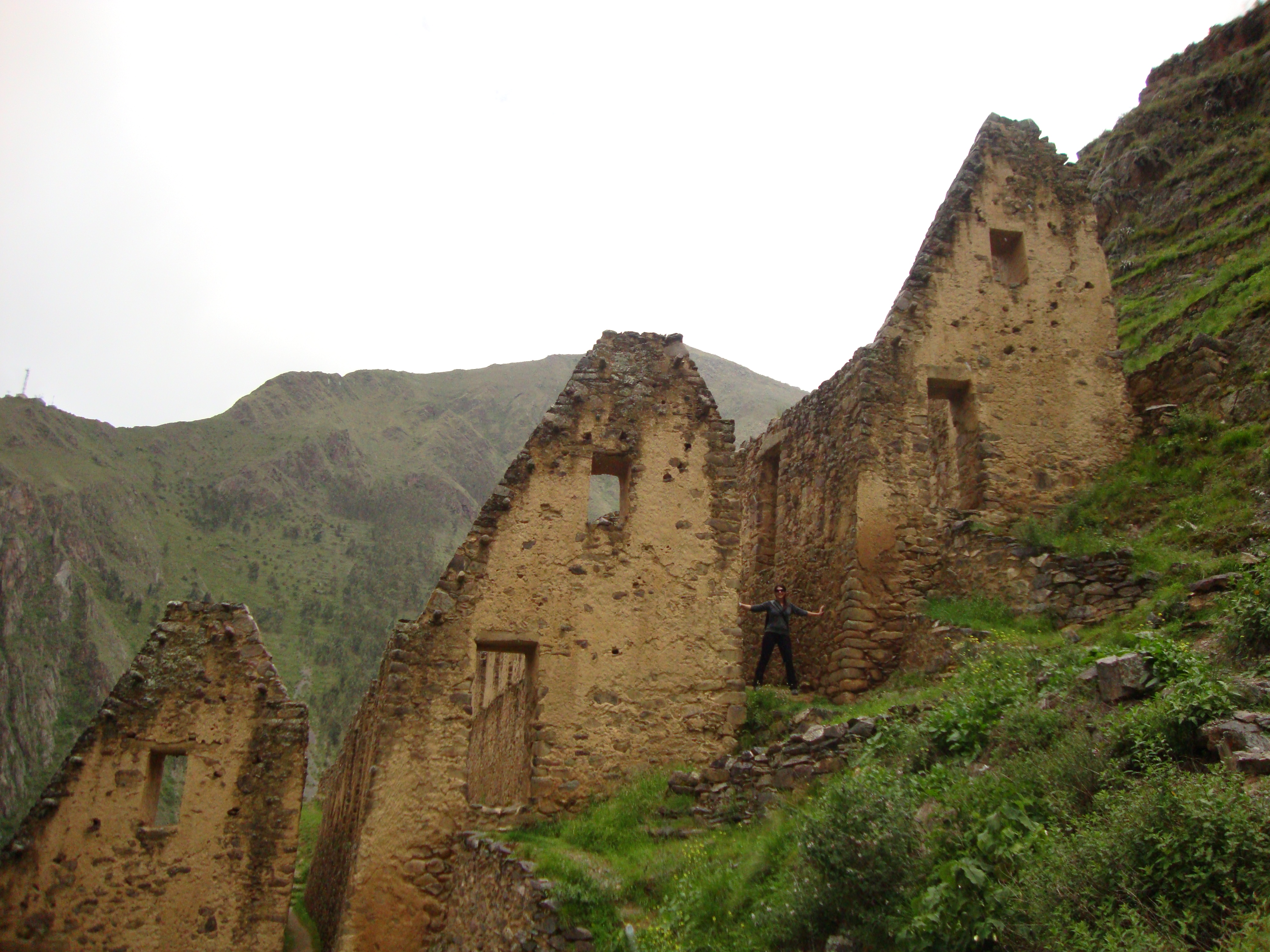
me!
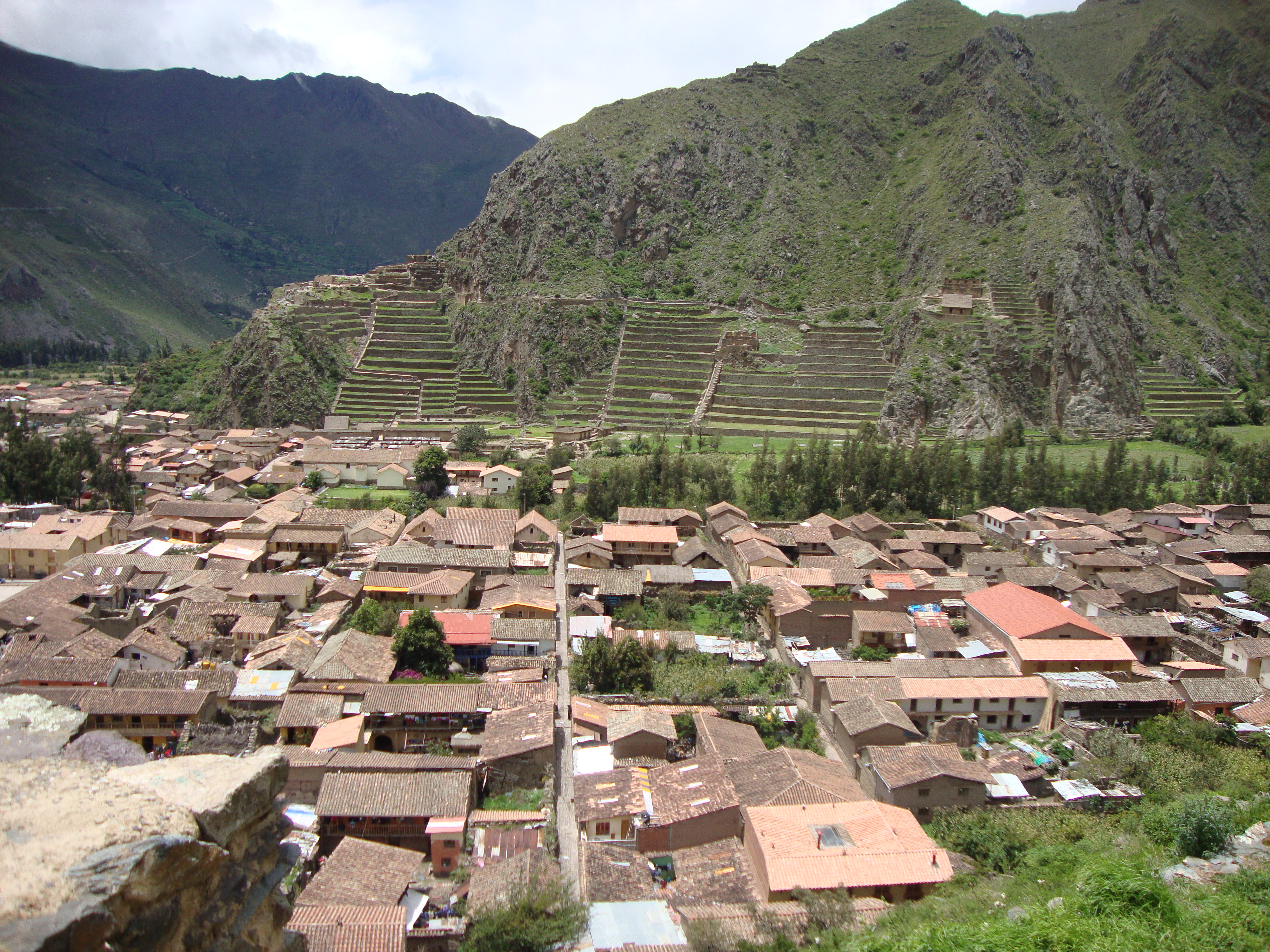
La Forteleza y Intiwatana
The Incas seemed to like two things: trapezoids and terracing things. All the doors and windows (they’re not actually windows, but more like alcoves built into the wall for offerings to the gods) are trapezoids, and even the layout of the original city was a trapezoid, with the main plaza situated at the wider, lower end. As for terracing, it seems that the Incas terraced pretty much any slope they could find, which is a lot when you’re in the middle of the mountains. The largest set of terraced fields are adjacent to the temple and fortress, right outside of town. You normally have to pay to get in to see these ruins, but there is a way you can sneak in to the site by trekking through some cornfields and crossing a smallish stream or two. VIctor, my host dad, snuck me and Nicki in to the ruins this way and basically gave us a private tour, because he seems to know everything about this place and how things were in the time of the Incas. He told us how terracing the mountainside actually allowed the Incas to take advantage of the different altitudes and grow different crops at each level. We walked up the stone steps adjacent to the terraces to the main fortress, which also housed a temple, ceremonial baths, and residences. Here is the wall of the six monoliths (six gigantic stones the Incas somehow sanded to a perfect smoothness), which made up the Temple of the Sun, and also slightly lower down is the Temple of the Moon.
view of ollanta, the fortress, and terraced fields from pinkyulluna
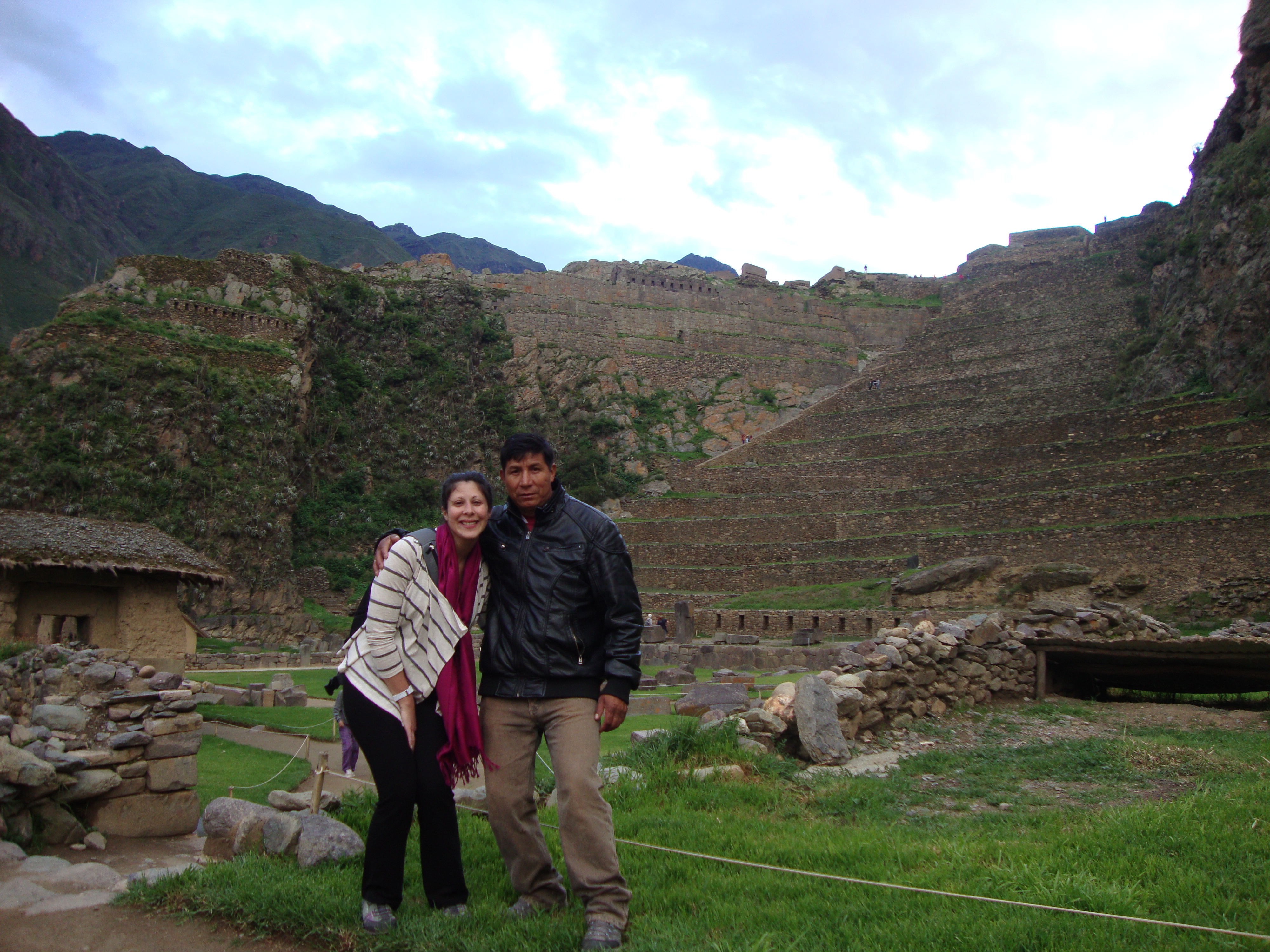
me and victor at the base of the ruins
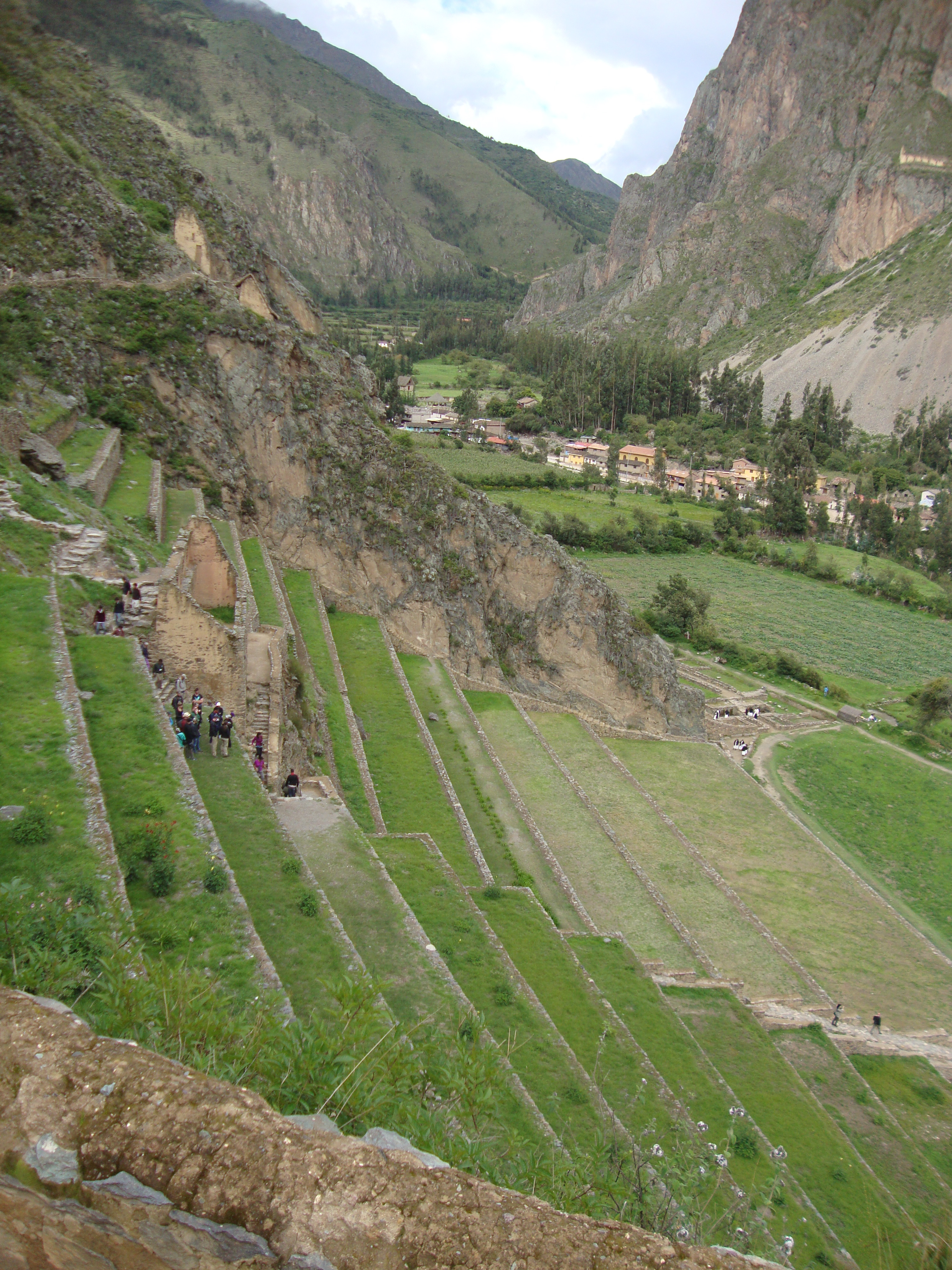
view of the terraced fields from the fortress
Higher up the mountain, above the fortress and temples, are the Intiwatana ruins. Intiwatana means “sun fastener,” and it is assumed that these structures were at once an astronomical observatory and altar for sacrifices, but it looks suspiciously like a place to hold prisoners.
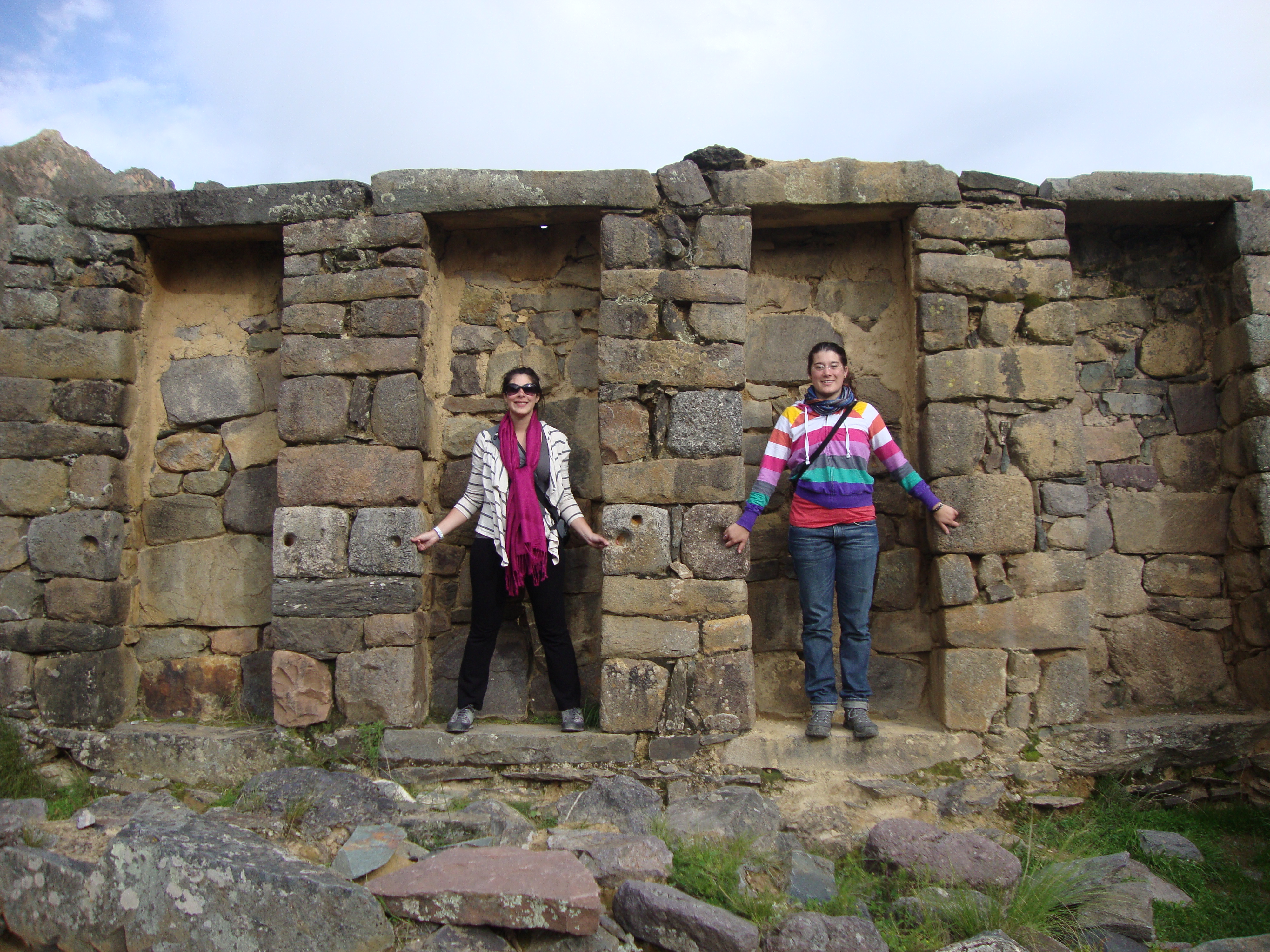
me and nicki at intiwatana
From here you can see how the building of Ollantaytambo at this location was no accident – it was strategically positioned at the place where the Patacancha River empties into the Urubamba River, at the crux of these two river valleys, giving its residents access to and control of the mountains to the north (and the jungle beyond), Machu Picchu to the west, and to the rest of the Sacred Valley and Cusco to the south and east.
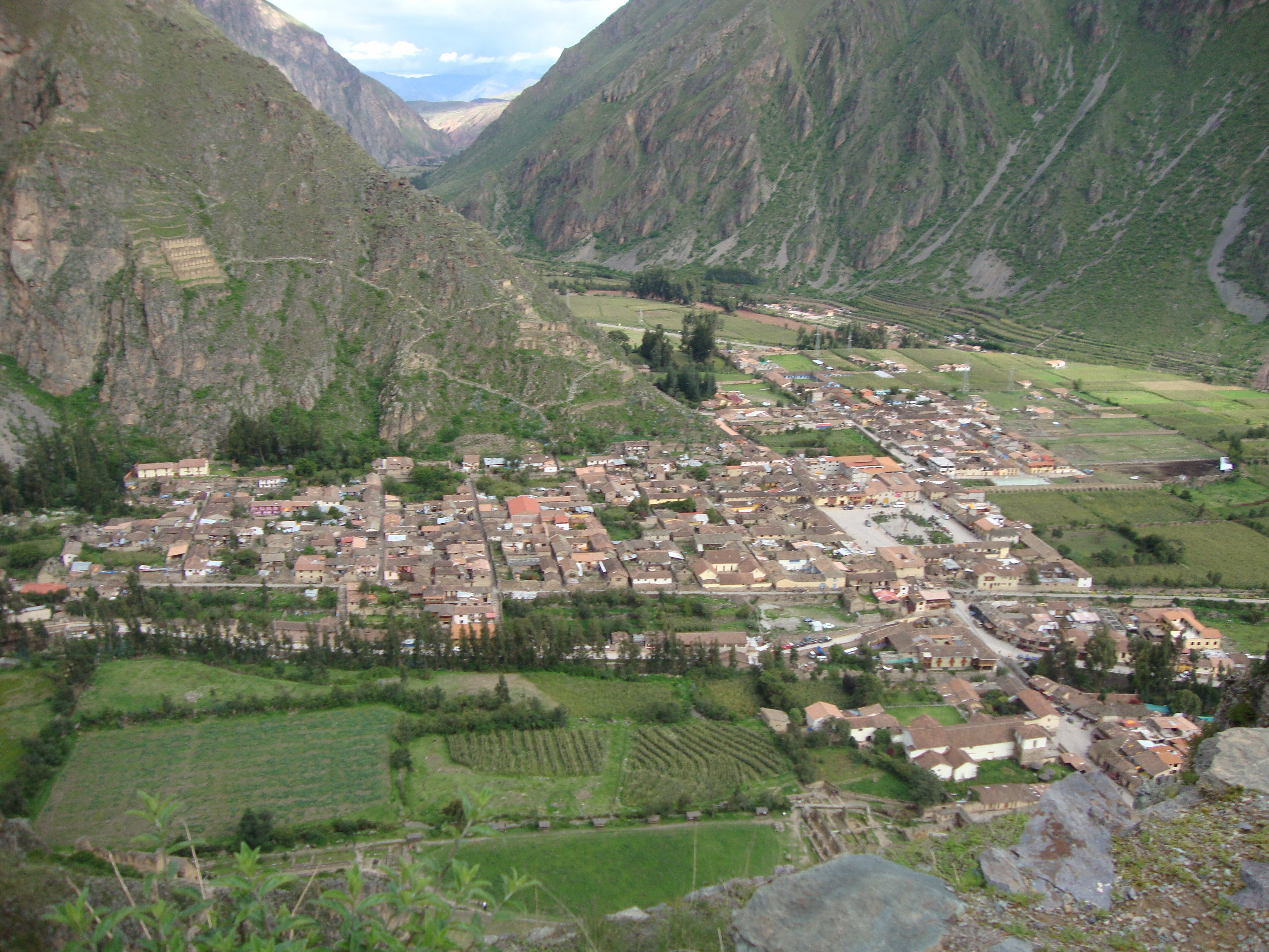
view of ollanta from intiwatana – straight ahead is the urubamba valley (sacred valley) and to the left is the patacancha valley.
next: salineras!
